![](/images/other/stat-length.png)
![Tocht Stappen Kastelruth - Castelrotto - Seiser Alm - Photo](https://media.geolcdn.com/t/1900/400/ext.pjpeg?maxdim=2&url=https%3A%2F%2Fservices.sitytrail.com%2FGeolivesWS%2FDownloadMedia.ashx%3FTrailID%3D1008019%26Media%3Dfix__20180719142057.jpg)
Seiser Alm
VacheKiri67
Gebruiker
![Lengte](/images/other/stat-length.png)
Lengte
10,5 km
![Max. hoogte](https://static1.geolcdn.com/siteimages/upload/files/1508320355ic_sort_altitude_max_24dp.png)
Max. hoogte
2020 m
![Positief hoogteverschil](https://static1.geolcdn.com/siteimages/upload/files/1508320355ic_sort_den_pos_24dp.png)
Positief hoogteverschil
238 m
![Km-Effort](/images/other/stat-length.png)
Km-Effort
13,7 km
![Min. hoogte](https://static1.geolcdn.com/siteimages/upload/files/1508320355ic_sort_altitude_min_24dp.png)
Min. hoogte
1833 m
![Negatief hoogteverschil](https://static1.geolcdn.com/siteimages/upload/files/1508320355ic_sort_den_neg_24dp.png)
Negatief hoogteverschil
240 m
![Boucle](https://static1.geolcdn.com/siteimages/upload/files/16400158638029165_repeat_loop_refresh_sync_direction_icon.png)
Boucle
Ja
Datum van aanmaak :
2018-07-27 13:29:02.164
Laatste wijziging :
2018-07-27 13:29:02.341
![Stappen](https://static1.geolcdn.com/sitytour/trail-icons/101.png)
3h34
Moeilijkheid : Gemakkelijk
![Scan deze QR-code om de tocht te openen in de SityTrail-applicatie](https://capi.geolives.com/qq0zvz2zws4bq2lad0pu/sitytour/trails/1008019/qr.png?size=200)
Gratisgps-wandelapplicatie
Over ons
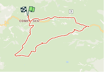
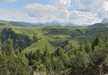
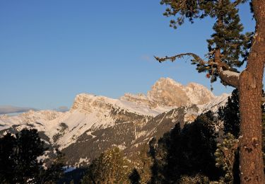
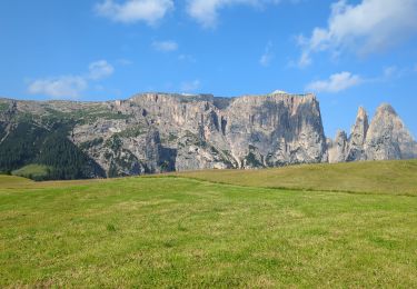
Tocht Stappen van 10,5 km beschikbaar op Trento-Zuid-Tirol, Bolzano - Bozen, Kastelruth - Castelrotto. Deze tocht wordt voorgesteld door VacheKiri67.
Beschrijving
Faite le 19/07/2018 avec notre fils Théo de 13 ans. D'après "Rundwanderung auf der Seiser Alm" du site www.sentres.com mais avec une variante pour le retour.
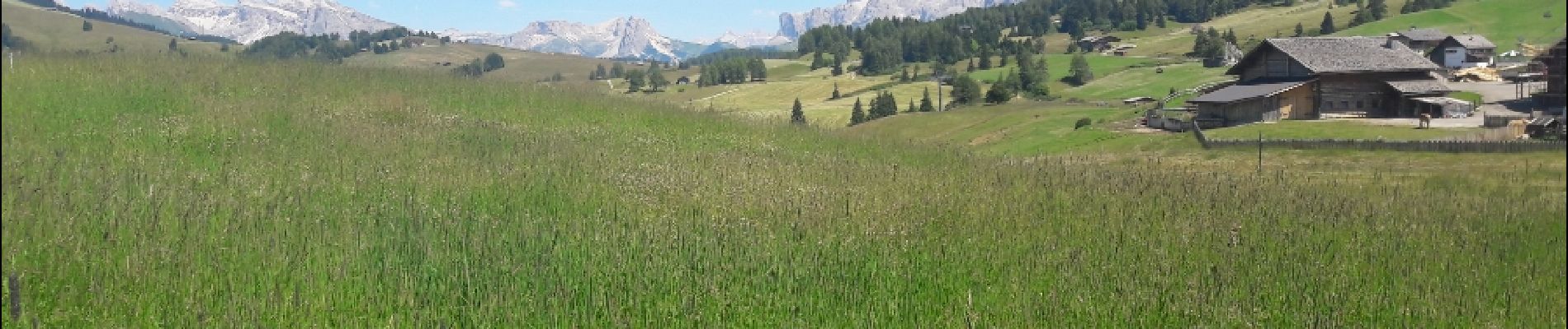
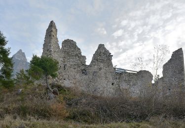
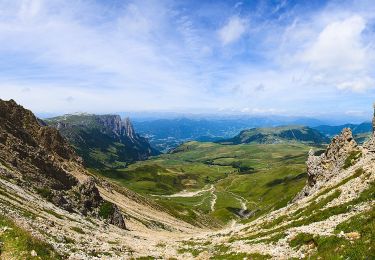
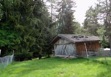
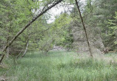
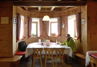
Plaatsbepaling
Land:
Italy
Regio :
Trento-Zuid-Tirol
Departement/Provincie :
Bolzano - Bozen
Gemeente :
Kastelruth - Castelrotto
Locatie:
Unknown
Vertrek:(Dec)
Vertrek:(UTM)
700661 ; 5157643 (32T) N.
Opmerkingen
Wandeltochten in de omgeving
![Tocht Te voet Kastelruth - Castelrotto - Oswald-von-Wolkenstein-Weg - Photo](https://media.geolcdn.com/t/375/260/0a8b9b3d-8be5-4949-974d-1d334c273e90.jpeg&format=jpg&maxdim=2)
![Te voet Te voet](https://static1.geolcdn.com/sitytour/trail-icons/100.png)
Oswald-von-Wolkenstein-Weg
Te voet
Gemakkelijk
Kastelruth - Castelrotto,
Trento-Zuid-Tirol,
Bolzano - Bozen,
Italy
![](/images/other/stat-length.png)
3,4 km | 5,7 km-effort
1h 18min
![](https://static1.geolcdn.com/siteimages/upload/files/16400158638029165_repeat_loop_refresh_sync_direction_icon.png)
Ja
![Tocht Te voet Völs am Schlern - Fiè allo Sciliar - (SI C18N) Rifugio Bolzano - Rifugio Alpe di Tires - Photo](https://media.geolcdn.com/t/375/260/2b3b6c37-933d-47c7-866c-9c42000bd74c.jpeg&format=jpg&maxdim=2)
![Te voet Te voet](https://static1.geolcdn.com/sitytour/trail-icons/100.png)
(SI C18N) Rifugio Bolzano - Rifugio Alpe di Tires
Te voet
Gemakkelijk
Völs am Schlern - Fiè allo Sciliar,
Trento-Zuid-Tirol,
Bolzano - Bozen,
Italy
![](/images/other/stat-length.png)
5,5 km | 9,4 km-effort
2h 7min
![](https://static1.geolcdn.com/siteimages/upload/files/16400158638029165_repeat_loop_refresh_sync_direction_icon.png)
Neen
![Tocht Te voet Kastelruth - Castelrotto - IT-10 - Photo](https://media.geolcdn.com/t/375/260/452074b7-2546-4dda-b2aa-124f39c83e52.jpeg&format=jpg&maxdim=2)
![Te voet Te voet](https://static1.geolcdn.com/sitytour/trail-icons/100.png)
IT-10
Te voet
Gemakkelijk
Kastelruth - Castelrotto,
Trento-Zuid-Tirol,
Bolzano - Bozen,
Italy
![](/images/other/stat-length.png)
7,1 km | 9,4 km-effort
2h 8min
![](https://static1.geolcdn.com/siteimages/upload/files/16400158638029165_repeat_loop_refresh_sync_direction_icon.png)
Neen
![Tocht Te voet Kastelruth - Castelrotto - 2B - Photo](https://media.geolcdn.com/t/375/260/ae8c64e8-a647-4e23-abe2-411e544afb44.jpeg&format=jpg&maxdim=2)
![Te voet Te voet](https://static1.geolcdn.com/sitytour/trail-icons/100.png)
2B
Te voet
Gemakkelijk
Kastelruth - Castelrotto,
Trento-Zuid-Tirol,
Bolzano - Bozen,
Italy
![](/images/other/stat-length.png)
3,1 km | 4,2 km-effort
57min
![](https://static1.geolcdn.com/siteimages/upload/files/16400158638029165_repeat_loop_refresh_sync_direction_icon.png)
Neen
![Tocht Te voet Kastelruth - Castelrotto - IT-5 - Photo](https://media.geolcdn.com/t/375/260/e1cc7a5e-e3cd-4887-a2e9-4c1bceaace35.jpeg&format=jpg&maxdim=2)
![Te voet Te voet](https://static1.geolcdn.com/sitytour/trail-icons/100.png)
IT-5
Te voet
Gemakkelijk
Kastelruth - Castelrotto,
Trento-Zuid-Tirol,
Bolzano - Bozen,
Italy
![](/images/other/stat-length.png)
5 km | 8,6 km-effort
1h 56min
![](https://static1.geolcdn.com/siteimages/upload/files/16400158638029165_repeat_loop_refresh_sync_direction_icon.png)
Neen
![Tocht Te voet Völs am Schlern - Fiè allo Sciliar - Touristensteig - Photo](https://media.geolcdn.com/t/375/260/57dc983a-b6a5-4288-944f-8fea0f41275d.jpeg&format=jpg&maxdim=2)
![Te voet Te voet](https://static1.geolcdn.com/sitytour/trail-icons/100.png)
Touristensteig
Te voet
Gemakkelijk
Völs am Schlern - Fiè allo Sciliar,
Trento-Zuid-Tirol,
Bolzano - Bozen,
Italy
![](/images/other/stat-length.png)
10,5 km | 15,7 km-effort
3h 34min
![](https://static1.geolcdn.com/siteimages/upload/files/16400158638029165_repeat_loop_refresh_sync_direction_icon.png)
Neen
![Tocht Te voet Kastelruth - Castelrotto - IT-9 - Photo](https://media.geolcdn.com/t/375/260/4b38568f-e1b6-42b9-96cf-c08768c59a51.jpeg&format=jpg&maxdim=2)
![Te voet Te voet](https://static1.geolcdn.com/sitytour/trail-icons/100.png)
IT-9
Te voet
Gemakkelijk
Kastelruth - Castelrotto,
Trento-Zuid-Tirol,
Bolzano - Bozen,
Italy
![](/images/other/stat-length.png)
10,3 km | 18,3 km-effort
4h 9min
![](https://static1.geolcdn.com/siteimages/upload/files/16400158638029165_repeat_loop_refresh_sync_direction_icon.png)
Neen
![Tocht Te voet Kastelruth - Castelrotto - IT-2 - Photo](https://media.geolcdn.com/t/375/260/2b3b6c37-933d-47c7-866c-9c42000bd74c.jpeg&format=jpg&maxdim=2)
![Te voet Te voet](https://static1.geolcdn.com/sitytour/trail-icons/100.png)
IT-2
Te voet
Gemakkelijk
Kastelruth - Castelrotto,
Trento-Zuid-Tirol,
Bolzano - Bozen,
Italy
![](/images/other/stat-length.png)
5,1 km | 10,6 km-effort
2h 24min
![](https://static1.geolcdn.com/siteimages/upload/files/16400158638029165_repeat_loop_refresh_sync_direction_icon.png)
Neen
![Tocht Stappen Kastelruth - Castelrotto - Schlern - Photo](https://media.geolcdn.com/t/375/260/d36457a9-cdc8-4fc0-a59e-01709009d44d.jpg&format=jpg&maxdim=2)
![Stappen Stappen](https://static1.geolcdn.com/sitytour/trail-icons/101.png)
Schlern
Stappen
Moeilijk
Kastelruth - Castelrotto,
Trento-Zuid-Tirol,
Bolzano - Bozen,
Italy
![](/images/other/stat-length.png)
14,9 km | 26 km-effort
7h 10min
![](https://static1.geolcdn.com/siteimages/upload/files/16400158638029165_repeat_loop_refresh_sync_direction_icon.png)
Ja